Geocoding Tabular Data
Problem
Provide an analysis on where current customers come from and to make recommendations for effective advertisement campaigns in areas less-well represented in the Wake County area of study.
Analysis procedures
Strategies
To solve this problem I need to create a map of Wake County by the distinct zip codes and then plot the initial customer data onto the map by the zip codes of the customer address's.
Next it was necessary to create two address locators for the customers. One depicting the zip code and the other combining streets and zip codes. These distinct locators enabled me to plot the desired results of customers.
The tools necessary to accomplish this analysis are ArcGIS Maps and ArcGIS Catalog utilizing the address locator tools.
Methods
I used process's that were fairly straight forward by first adding the primary files to support the map including the customer table, the wake county zip code districts shape file and the wake county boundary file. I then utilized the tools within ArcCatalog to create the first Address Locator file to match the customer address to the wake county zip codes. This plotted the customer information to each specific zip code region.
The second step was to identify customers by both street address and zip code. I then added the Wake County Streets shape file. I then crated another table from the customer file to create a unique address combining the street number and street name to one field. This allowed the new Address Locator to successfully match the correct address to the streets and zip code files creating a shape file called customer street addresses in my file.
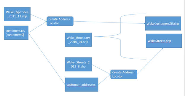
Process diagram / workflow diagram
Results
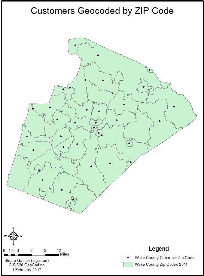
Customers geocoded by Zip Code associated with their account.
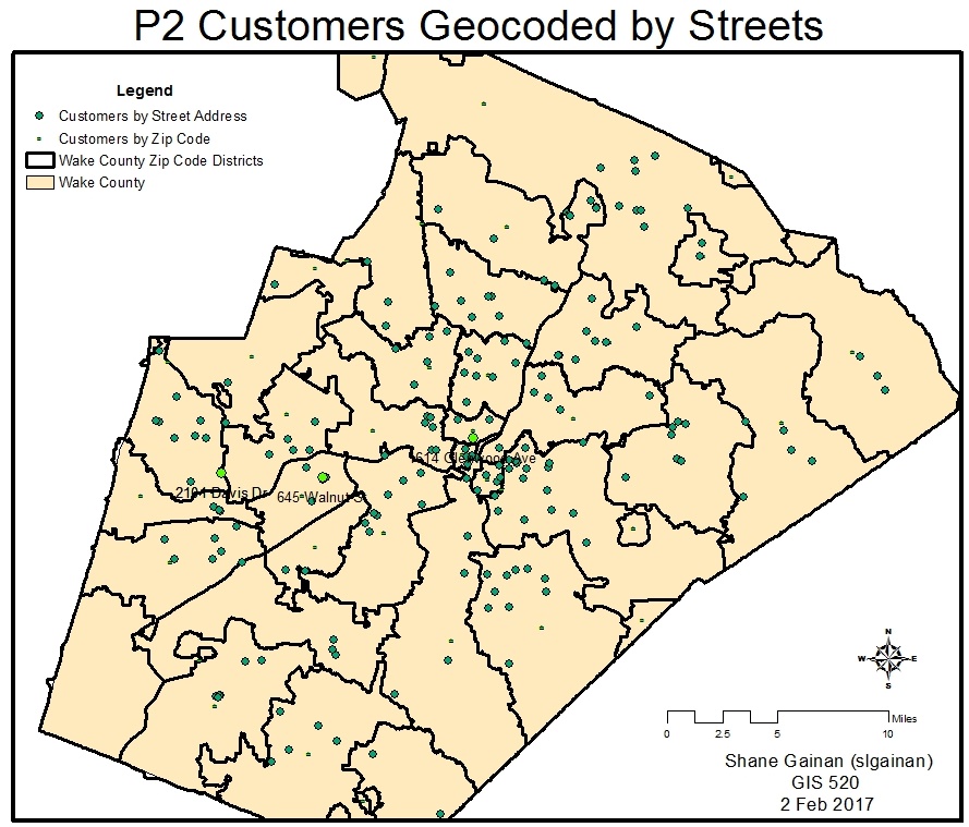
Customers geocoded by Street within the Zip Code associated with their account.
Application and Reflection
Problem Description
I believe this could be used to help model or do analysis on all sorts of markets to include industries such as cell tower locations were you may want to check the coverage of cell towers in a particular area or conduct analysis on hunting harvest reports by county.
Data Needed
Utilizing county shapefiles of the state of interest, US Postal Zip Code files, and tabular data of harvests by species and by zip codes.
state data and zip code data can be collected from sites such as the following links.
NC OneMapZip Code Points
Analysis procedures
Utilizing current zip codes and map locations of each county i would conduct a join operation of the tabular data from the harvest reports and then complete an analysis by zip code of animals harvested by county. I would then create a thematic map showing areas with high hunting pressure and harvest reports compared to low pressure areas.