Welcome to my MGIST Portfolio
All the images in this portfolio can be enlarged for better review by simply clicking on them.
______________________________________________________________
In this portfolio you will find the completed projects from my Master of Geospatial Information Science and Technology (MGIST) at North Carolina State University. The work showcased here draws on the full MGIST curriculum, which included the following courses:
- GIS 510 – Intro to Geospatial Information Science
- ST 507 – Statistics for the Behavioral Sciences I
- GIS 530 – Principles of GIS
- GIS 512 – Introduction to Environmental Remote Sensing
- GIS 540 – Geospatial Programming
- GIS 520 – Spatial Problem Solving
- GIS 550 – Geospatial Data Structures and Web Services
- GIS 515 – Cartographic Design
- MEA 582 – Geospatial Modeling
- GIS 590 – GIS Master’s Project
- GIS 660 – MGIST Portfolio
Collectively, these courses provided a foundation in advanced geospatial analytics, spatial problem solving, programming, remote sensing, cartography, web-based geospatial data services, and geospatial modeling.
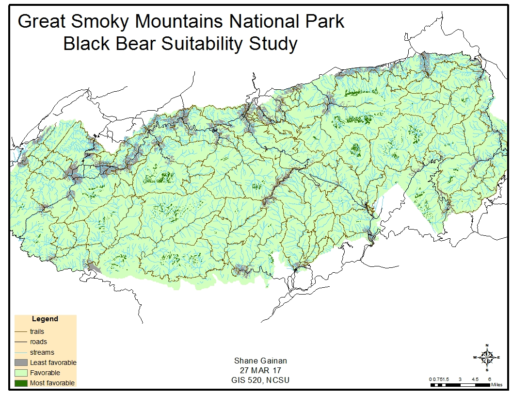
The projects in this portfolio demonstrate how I integrate data from multiple sources, perform spatial analysis, and present results visually and analytically through maps, graphics, and other geospatial products—for example, the site suitability study illustrated above.
Through this program I learned to apply a wide range of geospatial tools and methods to support accurate, evidence-based decision making in practical, real-world contexts.
Please use my contact page if you have any questions about the projects or methods presented in this portfolio.